The Crooked River is a highly sought after run for western boaters. The flows are inconsistent so it typically only runs a few days each year if at all.. It is one of those rivers that once it is flowing many paddlers drop everything and head to put-in as it may be the only time that year there is water.
Trip Highlights
Mile 0: Put-in at Lone Pine Rd Bridge just outside the small town of Terrebonne Oregon. Parking here is very limited and just along the road. When the river is running you may see a handful of cars parked with boaters getting ready.
Mile 2.3: Alternate river access - you can skip the first 2.3 miles of flatwater by carrying your boats down a dirt road that begins where a water canal crosses NE Wilcox Rd.
Mile 2.35: Initiation (IV) starts 1.5 miles of continuous class III+ to IV read and run rapids. This is a good warm up and will help you get a feel for the other larger rapid on the river.
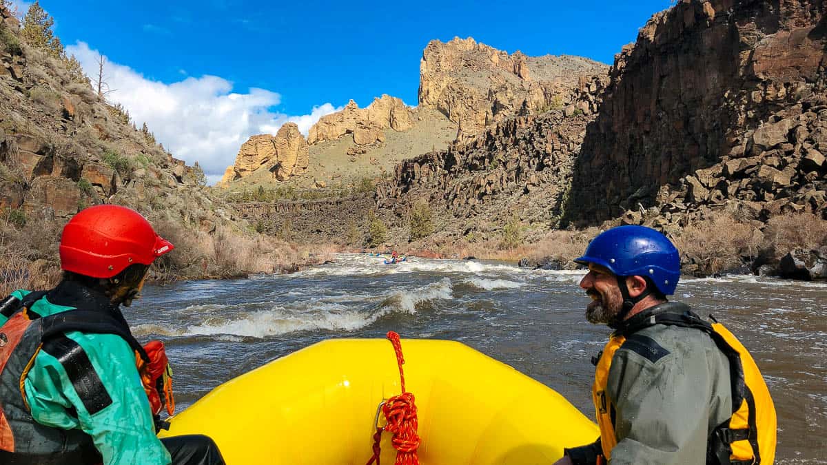
Initiation Rapid above Smith Rocks State Park
Mile 3.85: After Initiation, you enter Smith Rocks State Park. You may see climbing scattered through out the walls and spires of the park. Enjoy some flat water as you float through the park.
Mile 4.5: Float under a footbridge that rafts can typically limbo under at flows below 3500 cfs. At higher flows this footbridge may be a portage.
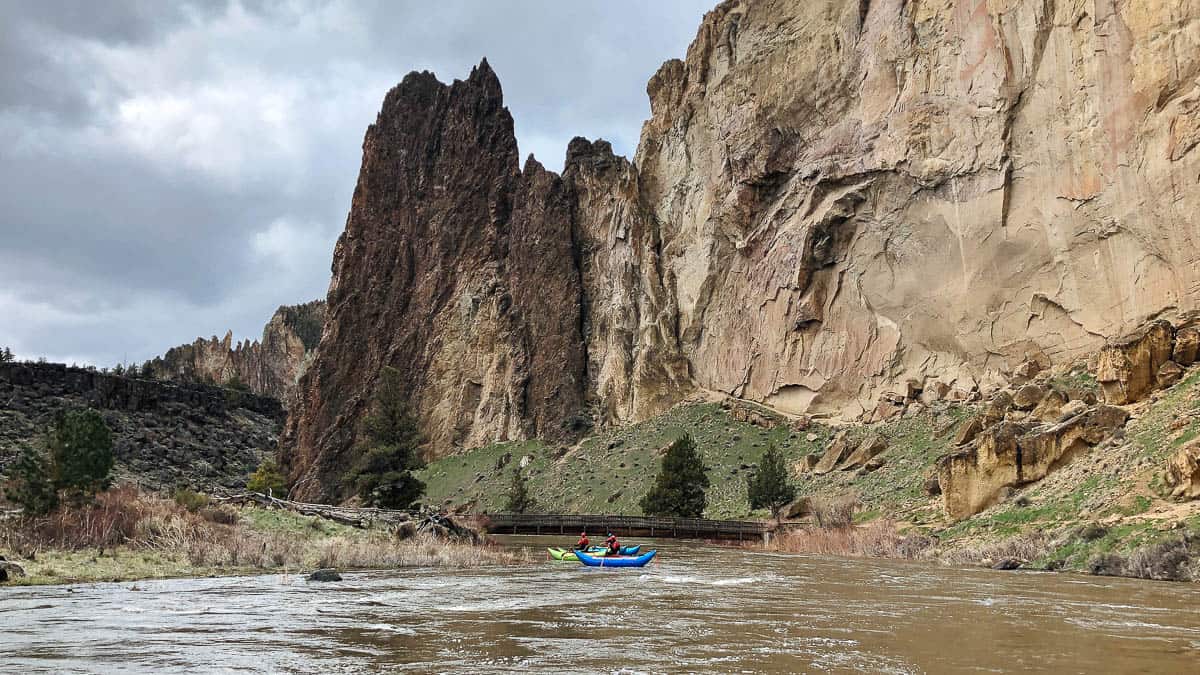
Paddling under the footbridge in Smith Rock State Park at 3400 cfs
Mile 7.5: Once you have left Smith Rocks you come to the first big rapid, Number One (IV). This rapid should be scouted on the right as the lines change with varying flows.
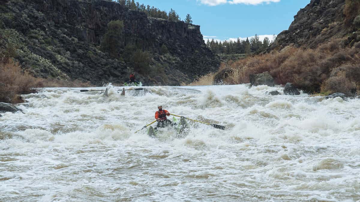
Number One on the Crooked River at 3400 cfs
Mile 8.85: A bridge crosses the river followed by an old footbridge with a cable that can be problematic at flows above 3500 cfs.
Mile 9.3: Number Two (IV) can be scouted on the the right. There is a bit of a recovery pool at the bottom before the action picks in the section known as The Bumps.
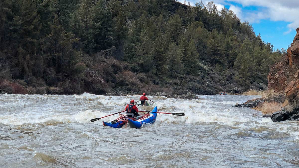
Right side of the Island in Number Two Rapid on the Crooked River
Mile 10.4: Wap-de-Doodle (IV) comes quickly after the river bends to the left. This is one of the more intimidating rapids with some big holes, waves, and a couple different lines. Scouting is tough but can be done from the right or the left side of the river.
Mile 11.6 There are a bunch of fun class III rapids with some fun drops that keep things exciting as you move down stream. The three bridges that span the Crooked River at Peter Skene Ogden State Scenic View Point are a nice marker of where you are at on the river.
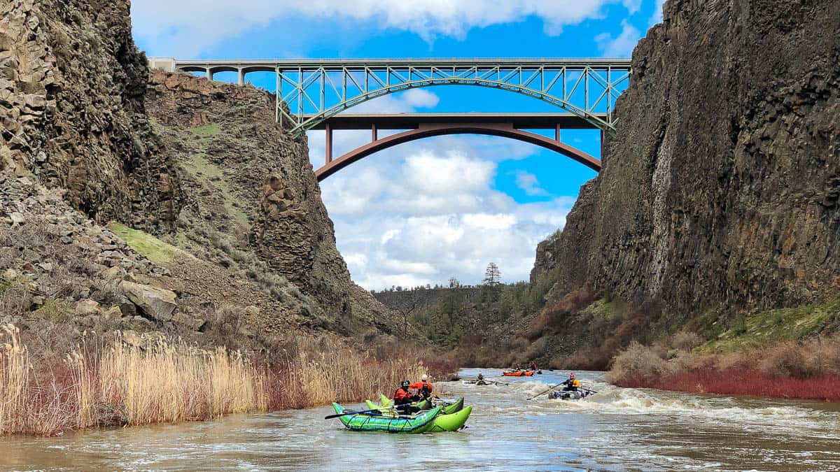
Floating below the bridges at Peter Skene Ogden State Park
Mile 15.1: No Name (V) follows after a few miles of fun class III and IV rapids. This rapid should be scouted thoroughly from the right side and the scout eddy is sometimes missed by groups not paying attention.
Mile 17: China Dam (V) is a nasty rapid formed by an old dam that comes after a long pool. There is a big hole after the dam that can easily flip rafts and could lead to a long swim. Most kayakers take-out above China Dam. Portaging or taking rafts out above China Dam would be a lot of work.
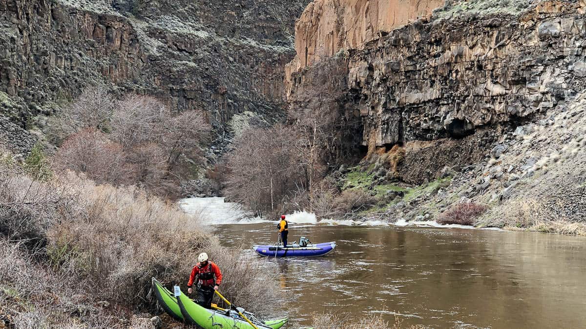
Heading into China Dam on the Crooked River
Mile 17.05: Hollywood Road (no vehicles allowed) is a hike out trail. If you take out above China Dam scrambled up to catch the road. If you run the rapid you will meet the road down near the river. The hike out is 0.7 mile with 400 feet of elevation gain.
Mile 18.6: V-Wave (IV - V) is a big steep drop ending in a huge wave or hole that should be scouted.
Mile 22.3: One of the major obstacles is a portage around Opal Springs Dam. The portage can be as long as 1/4 mile.
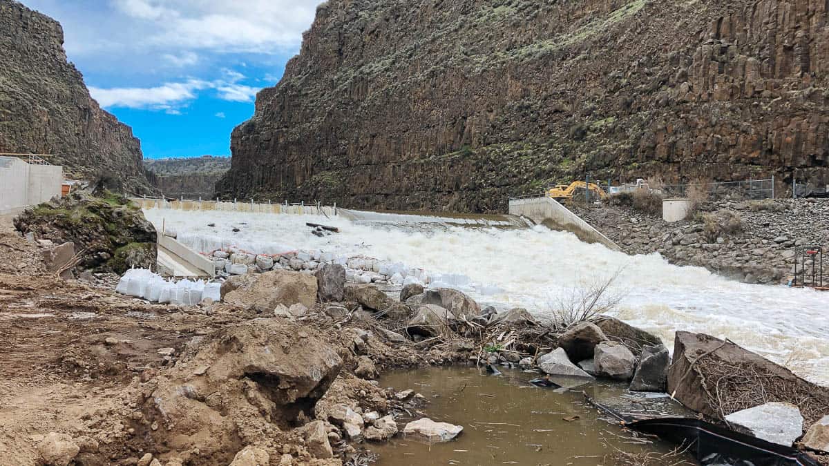
Opal Springs Dam on the Crooked River
Mile 23.2: When Lake Billy Chinook is full the reservoir begins. Contact Cove Palisades Resort to set up a tow across the reservoir.
Mile 28.6: Cove Palisades Resort makes a good take-out with access to the reservoir and parking.

